logo mali bijeli okvir.fw

General information

THE PROCLAMATION DATE:  October 19th, 1949

THE HIGHEST PEAKS: Vaganski vrh (1757 m a.s.l.) and Sveto brdo (1753 m a.s.l.)

INTERNATIONAL DESIGNATIONS:

- Velebit Mountain Biosphere Reserve (UNESCO MaB), February 10th, 1978
- Ecological network NATURA 2000  December 1st, 2014
- UNESCO World Heritage Site, July 7th, 2017

"Manita peć" Cave

 MG 5015Manita pec
Among 115 speleological objects so far known in the Paklenica National Park, Manita peć is the most famous among the visitors, as it is the only show cave made accessible to the public through guided visits. The cave's broad chambers and the beauty of its speleothems have been enchanting visitors since 1937. It is located at an altitude of 570 m a.s.l, and the walk up from the parking lot at Velika Paklenica takes about 1.30 h.

More

Hiking trails

Planinarski dom Šime Sorić meni module

Hiking is the only way to truly get to know Paklenica. The Park area contains 150-200 km of trails and paths, from those characterized as tourist trails - leading from Velika Paklenica canyon to Manita peć cave, Lugarnica foresters house and Paklenica Mountain hut, to those characterized as hiking trails - leading to the highest peaks of the Velebit Mountain.


More


 DSC 6311

Climbing site

Paklenica National Park is the most visited climbing center in Croatia, also popular outside Croatia. The close proximity of seawater gives this climbing site a special charm, making Paklenica Riviera an ideal place to combine climbing and water sports. Today, there are about 500 well-equipped marked routes of different difficulty and length (from grade 3 to 8b+), set in the carbonate rocks, so each climber can find something to his/her liking.

More

X
       Specific WH EN bossen Positief

Water

image005

Watertight sediments are situated beneath very porous karstic deposits of carbonate rock in the extended part of Velika Paklenica, Brezimenjača, and in the springs of Mala Paklenica and the occasional flow of Orljača.  
      
Due to the combination of watertight and porous sediments, Paklenica National Park has several permanent or occasional flows and many permanent springs. The permanent springs of high-quality drinking water are Stražbenica, Kontinovo vrilo, Crno vrilo and Pećica.
The most powerful spring is the Ivine vodice spring at the altitude of around 1200 m a.s.l., followed by Kontinovo vrilo at 870 m a.s.l., Crno vrilo at 780 m a.s.l., and Jukića vrilo at 600 m a.s.l. The Vratrovac spring is located above Ramići, and the spring of the occasional of Brezimenjača is located at around 1000 m a.s.l. The Suva draga spring is at the same altitude.

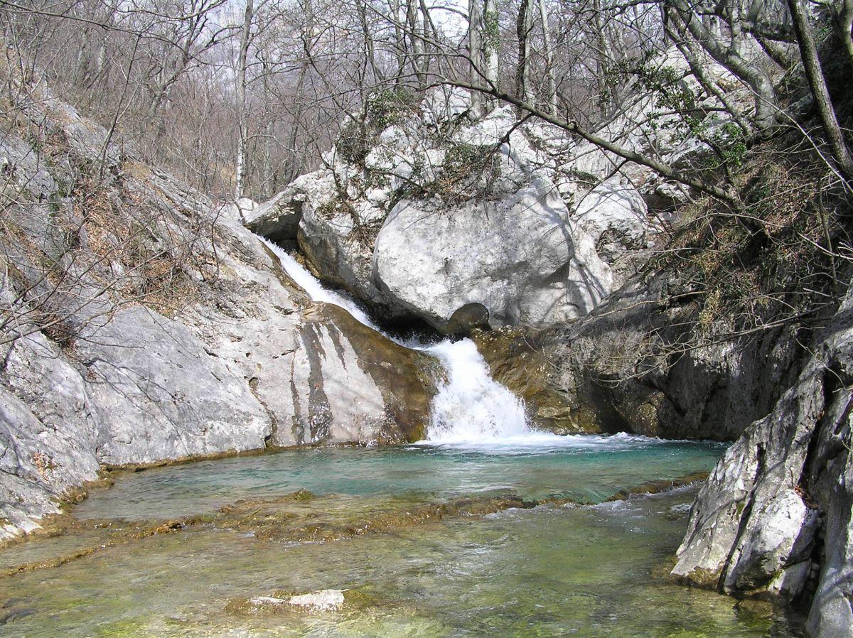
The Velika Paklenica stream normally sinks in the area beneath Anića luka. It flows in its entire length into the sea during the rainy season in spring, autumn, and winter.

The Mala Paklenica stream springs above Vlaškogradska draga at around 1 000 m a.s.l. Its capacity is lesser, depending on the season and precipitation. The flow gradually descends to the parallel flow of Orljača, and the stream is active in the canyon during rainy autumns, winters and early springs, when the torrent flow of Orljača, springing beneath the slopes of Sveto brdo, flows into it at 484 m a.s.l..
The spring of Staro vrilo is located in the area of Velika Močila, as well as a few more seeping streams. The seeping springs occur also in Mala Močila during the humid parts of the year. In the highest zone of Velebit, a permanent water body can be found in Babino jezero beneath Babin vrh.


Image

Javna ustanova Nacionalni park Paklenica
Dr. Franje Tuđmana 14a
HR - 23244 Starigrad-Paklenica

Tel.: +385 (0) 23 369 155, 369 202 (Direction)

       +385 (0) 23 369 452  (Camp "Nacionalni park")
       +385 (0) 23 369 803 (Entrance 1 Velika Paklenica)


E-mail:
np-paklenica@paklenica.hr
prezentacija@paklenica.hr (info)

OIB: 24913665146
IBAN: HR0824070001100579272, OTP banka

Image

IZJAVA O ZAŠTITI PRIVATNOSTI I SIGURNOSTI OSOBNIH PODATAKA